Tropical Disturbance Gains Strength in Gulf, Depression Anticipated to Form.
A tropical disturbance in the Gulf of Mexico is strengthening and expected to develop into a depression soon, with an 80% chance of development over a week. Florida and surrounding areas should prepare for heavy rain and winds, with possible flooding. The storm, likely named Milton, is anticipated to affect the region late Tuesday into Wednesday. A new tropical wave also exists off Africa’s coast.
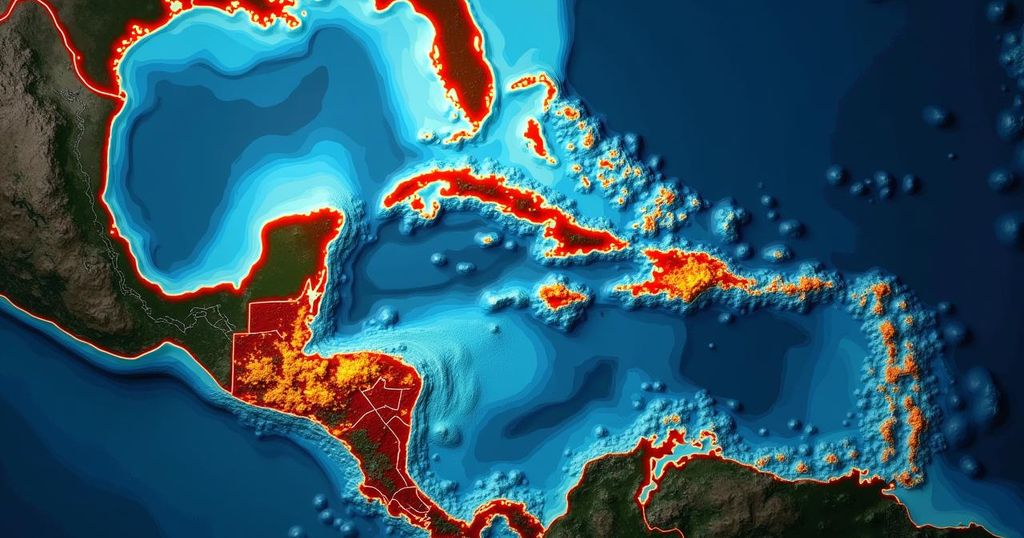
TAMPA, Fla. (WFLA) — A tropical disturbance located in the Gulf of Mexico is exhibiting signs of strengthening and is anticipated to develop into a tropical or subtropical depression in the forthcoming days, as stated by the National Hurricane Center (NHC). In an update released at 2 a.m. on Saturday, the NHC indicated an 80% probability of development over a seven-day period, alongside a 50% chance of transformation into a depression within the next 48 hours. Although the low-pressure area remains broad, it is generating winds that approach gale force. According to Max Defender 8 Meteorologist Rebecca Barry, “We expect a tropical storm or a Category 1 hurricane to track across the state late Tuesday night into Wednesday.” The system is expected to receive the name Milton, the next designated name in this year’s hurricane list. Residents of Florida, the Yucatan Peninsula in Mexico, and the Bahamas are advised to closely monitor the system as it progresses eastward or northeastward across the Gulf of Mexico. Barry further emphasized, “It’s too soon to tell what areas will be impacted the most, as that will depend heavily on landfall location.” The NHC predicts that gusty winds and substantial rainfall are likely to affect Florida and parts of Mexico beginning late this weekend and extending into early next week. Max Defender 8’s Chief Meteorologist Jeff Berardelli remarked that heavy rainfall will commence on Sunday as the initial moisture surge reaches Florida’s coastline. It is anticipated that rainfall patterns will oscillate between periods of intense showers and dry spells through Tuesday. “Given that the ground is saturated after one of the rainiest wet seasons on record, any downpours will lead to flooding,” Berardelli added. The storm’s precise trajectory and intensity upon reaching Florida by Wednesday remain uncertain; however, forecasted rainfall amounts from Central to South Florida could range between 5 to 10 inches. Additionally, a new tropical wave has emerged off the coast of Africa, exhibiting a 30% chance of development within the next seven days as it traverses the Atlantic. The NHC has acknowledged that some development is feasible. Meanwhile, Hurricane Kirk persists in the Open Atlantic, with anticipated large swells expected to reach the U.S. East Coast by Sunday. Hurricane Leslie in the Tropical East Atlantic has exhibited slight strengthening and continues its west-northwestward progression. For ongoing updates, viewers may refer to “Tracking the Tropics” airing on Tuesdays at 12:30 p.m. ET/11:30 a.m. CT. Residents are also encouraged to prepare with the 2024 Hurricane Guide and subscribe to the Tracking the Tropics newsletter for timely updates on tropical developments.
The Gulf of Mexico frequently serves as a breeding ground for tropical disturbances and hurricanes, especially during the Atlantic hurricane season, which typically runs from June 1 to November 30. The National Hurricane Center plays a critical role in monitoring and forecasting these movements, keeping the public informed of potential threats. This particular disturbance presents an opportunity to understand the dynamic nature of weather systems in warm oceanic waters and the impacts they can have on nearby coastlines. The meteorological factors influencing storm development, including wind patterns and ocean temperatures, are crucial for accurate forecasts. As evidenced by previous seasons, even subtle changes in these factors can lead to significant weather events, including flooding and intense winds. Furthermore, effective communication of storm risks to the public is paramount for preparedness and safety.
In summary, a tropical disturbance in the Gulf of Mexico is likely to strengthen and may develop into a depression shortly. Florida and nearby regions should remain vigilant as the system is anticipated to bring challenging weather conditions, including heavy rainfall and gusty winds, beginning this weekend. While the exact impacts remain uncertain, there is potential for significant rainfall and flooding, particularly in already saturated areas. Continuous monitoring and preparedness engagement are essential as the situation evolves.
Original Source: www.wfla.com


Post Comment