Current Status of Tropical Invests 94L and 95L: Implications for Florida Residents
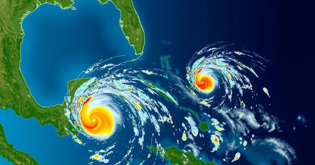
The National Hurricane Center is tracking Invests 94L and 95L, neither of which poses a direct threat to Florida at this time. Invest 94L will impact Puerto Rico and Hispaniola with heavy rainfall, while Invest 95L may affect Central America and Mexico. Overall, no significant development is expected over the next ten days according to meteorologists, although conditions may become conducive for tropical formation later this month.
The National Hurricane Center (NHC) is currently monitoring two investigatory systems in the tropics: Invest 94L and Invest 95L. Fortunately for residents of Florida, neither system poses a direct threat at this time. Invest 94L, which had previously displayed potential to evolve into Tropical Storm Nadine, is expected to bring heavy rainfall to Puerto Rico and Hispaniola. Meanwhile, Invest 95L shows some promise of forming into a short-term tropical depression or potentially Tropical Storm Nadine, likely impacting Central America and Mexico by Saturday, according to NHC advisories. The outlook is encouraging for those recovering from hurricanes Helene and Milton, as no significant tropical developments are anticipated over the next ten days, based on the latest forecasts from Colorado State University meteorologists. The two next potential storm names for the season are Nadine and Oscar. Meteorologists forecast a 50% likelihood of tropical development during the two-week period from October 15 to October 28, although current prospects for Invests 94L and 95L remain low. Colorado State University experts indicated that there are indications of possible tropical developments in the western Caribbean later in this period, though these indicators appear weak. Dr. Ryan Truchelut of WeatherTiger expressed confidence that the imminent week and a half would not result in significant tropical threats to the continental United States. However, he cautioned that the hurricane season is not yet over, predicting favorable conditions for storm formation in the Caribbean from late October to mid-November. Furthermore, he noted, “There are solid indications that of a couple of weeks of unusually favorable upper-level winds are coming to the Caribbean starting at the very end of October and extending through mid-November.” Regarding Invest 94L, satellite-derived data suggests a low-pressure trough is causing showers and thunderstorms to extend several hundred miles beyond Puerto Rico. Any development of this disturbance is anticipated to be sluggish, persisting mainly northwestward towards Hispaniola and the Bahamas while encountering significant upper-level winds. The formation chance within the next 48 hours is low at 20%, with similar low chances projected over the next week. AccuWeather has advised that while northeastern winds are steering potential developments away from Florida, they may still cause rough surf and coastal impacts. As for Invest 95L, conditions have become more conducive for organization in the northwestern Caribbean. A broad area of low pressure north of eastern Honduras indicates a high formation chance of about 70% over the next 48 hours and one week. Though local heavy rainfall is predicted for Central America and southern Mexico due to this system, tropical warnings may be issued soon for residents in areas like Belize and the Yucatan Peninsula. The NHC emphasizes that Invests, short for investigations, are areas of low pressure monitored for potential development into tropical cyclones, and they do not constitute tropical depressions or storms until they develop further. The hurricane season remains active, with continuous updates from the NHC expected. Keeping vigilant during the Atlantic hurricane season, which runs from June 1 to November 30, is essential; therefore, one should stay informed through reliable channels and prepare accordingly for potential weather alerts as the season progresses, especially from mid-August through mid-October when activity peaks.
The National Hurricane Center (NHC) regularly monitors tropical systems to provide critical updates and forecasts for potential hurricanes and tropical storms. The organization uses a systematic approach to track disturbances known as “Invests,” which are preliminary areas of low pressure being assessed for storm potential. The current monitoring of Invests 94L and 95L is significant as it aligns with the broader context of the Atlantic hurricane season, which runs from June 1 to November 30. Historical data informs meteorologists about typical storm patterns, especially towards the end of the season when the likelihood of major storms decreases, yet vigilance remains crucial given unpredictable weather patterns. This article outlines the current tracking updates and potential impacts of these invests while underscoring the importance of preparedness among coastal communities, most notably in Florida.
In summary, while the National Hurricane Center is tracking Invests 94L and 95L, neither system is currently deemed a threat to Florida. Upcoming weather predictions suggest low potential for substantial tropical developments in the immediate future, although residents should remain alert for updates from meteorologists on any changes that may occur. As the hurricane season continues, it is prudent for communities to prepare for any eventualities, especially given indications of favorable storm development conditions in the Caribbean later this month.
Original Source: www.palmbeachpost.com


Post Comment