Seattle Weather Alert: Bomb Cyclone to Bring Severe Conditions
A bomb cyclone is expected to impact Seattle with strong winds, rain, and heavy snow in the Cascades starting Tuesday afternoon. Weather warnings are in place, indicating the potential for hazardous conditions, especially in mountainous regions. The summer weather will continue through the week with cooler temperatures and precipitation.
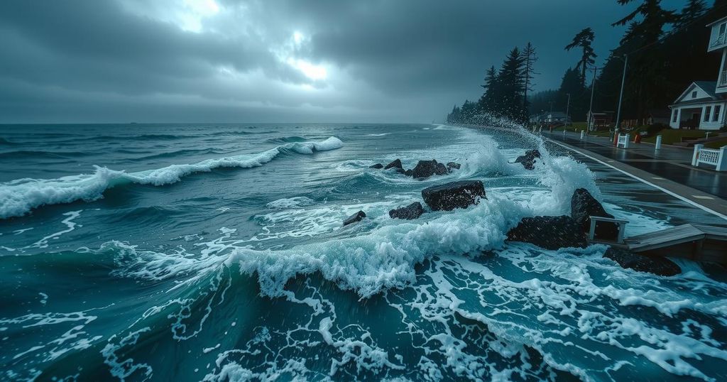
Weather conditions in Seattle are anticipated to change significantly due to an impending “bomb cyclone” approaching the Washington coast, which is expected to bring strong winds, heavy rainfall, and mountain snowfall. After a relatively calm Monday with scattered showers and cool temperatures, the forecast indicates that weather will intensify starting Tuesday afternoon. Overnight lows are projected to plummet into the mid to low 30s, with the possibility of mixed precipitation including snow as snow levels drop to about 1500 feet. While the day on Tuesday may start dry with morning clouds and occasional showers, winds and rain will escalate along the coast as the day progresses. High temperatures are expected to remain lower than average, reaching only the mid to upper 40s. A High Wind Warning and Wind Advisory will be in effect for Western Washington from Tuesday afternoon through early Wednesday morning, with gusts potentially reaching 65 mph along coastal regions and 45-50 mph in the Puget Sound area. The Cascades are predicted to experience heavy snowfall above 2500 feet, prompting a Blizzard Warning for mountain passes and a Winter Storm Warning for Central and Eastern Washington. The most severe rain, wind, and snowfall are projected to continue into Wednesday morning, with continual showers expected throughout the week and into the weekend, keeping temperatures cool along with further snowfall in the Cascades. The community is encouraged to remain alert as these weather events unfold, particularly in the mountain areas where travel may be impacted due to winter conditions. The public can expect ongoing updates as the situation develops.
The term “bomb cyclone” refers to a rapidly intensifying storm characterized by a drop in atmospheric pressure, leading to severe weather conditions including strong winds and heavy precipitation. In the context of Seattle and surrounding areas, meteorological patterns are shifting due to this cyclonic activity along the coast of Washington. This significant weather change can lead to hazardous conditions, especially in mountainous regions where snowfall can accumulate rapidly. It is essential for residents to stay informed about weather updates to ensure safety during such events.
In summary, Seattle is bracing for a bomb cyclone that is predicted to bring severe weather conditions, including strong winds, heavy rain, and significant snowfall in the mountain areas. With the weather set to deteriorate starting Tuesday afternoon, residents are advised to prepare accordingly and stay updated with local forecasts to navigate the impending challenges safely.
Original Source: www.fox13seattle.com


Post Comment