Weather
ADAMS, AFRICA, CASCADE, CASCADE RANGE, CLIMATE, EARTHQUAKES, EVACUATIONS, GETTY, GHANA, IMAGES, MOUNT ADAMS, NORTH AMERICA, RAIN, SEATTLE, SHALLOW EARTHQUAKE, SKAMANIA, SKAMANIA COUNTY, STATES GEOLOGICAL SURVEY CASCADES VOLCANO OBSERVATORY, TROUT LAKE, UNITED STATES, UNITED STATES GEOLOGICAL SURVEY, UNIVERSAL IMAGES GROUP, USGS, WA, WASH, WASHINGTON, WEATHER, WHITE SALMON - HOOD RIVER, YAKIMA
Daniel O'Connor
0 Comments
Scientists Deploy Additional Monitors at Mount Adams Volcano Amid Increased Seismic Activity
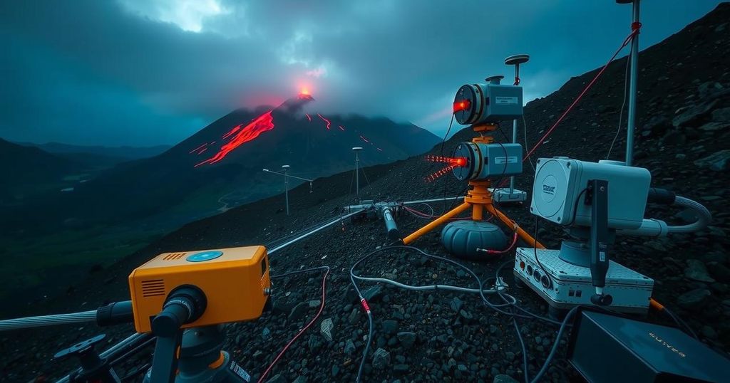
Scientists have deployed additional seismic monitors at Mount Adams, Washington, due to an unusual spike in seismic activity, with six earthquakes recorded in September 2024. Although there is no immediate threat, the research aims to assess the situation better. Mount Adams is a high-threat volcano, and historical events indicate a significant risk from lahars. Future findings may dictate additional safety measures.
Scientists from the United States Geological Survey (USGS) are responding to a heightened seismic activity observed at Mount Adams in central Washington, which has experienced an unprecedented six earthquakes in September 2024—an unusual number for this volcano that typically sees seismic events only every two to three years. To monitor this activity more effectively, researchers have deployed three temporary seismic monitoring stations in addition to the single permanent monitor in the vicinity. Current assessments indicate that there is no immediate cause for alarm, as informed by the USGS Cascades Volcano Observatory.
Mount Adams, recognized as a high-threat volcano located within the Cascade Range, has historical significance due to its size and volcanic activity. Approximately 50 miles southwest of Yakima, the volcano has been dormant for thousands of years, with the last known eruption occurring between 3,800 and 7,600 years ago. Nonetheless, the risk to local populations is significant, particularly from lahars, which are flows of volcanic debris that may arise during or after an eruption. USGS representatives note that historical lahars from Mount Adams have traveled considerable distances, posing risks to communities and infrastructure.
Given the potential impact of a volcanic event on nearby populations and air travel, the comprehensive assessment conducted by the USGS will determine whether further actions will be necessary based on the data collected from the newly installed monitoring stations.
The current monitoring of Mount Adams comes in light of recent unusual seismic activity, raising concerns among scientists about potential eruptions or associated hazards. Historically, Mount Adams has not exhibited explosive volcanic activity, but the presence of lahars owing to past landslides presents a significant risk. This situation necessitated the deployment of additional monitoring equipment to enhance the ongoing evaluation of seismic threats, thereby ensuring public safety in the event of future eruptions or other geological hazards.
In conclusion, the heightened seismic activity at Mount Adams has prompted scientists to install additional monitoring stations to better understand potential volcanic threats. While current assessments suggest no immediate danger, the historical context of the volcano’s activity emphasizes the importance of vigilance and preparedness for possible future eruptions and their implications for surrounding communities. The ongoing research will play a crucial role in determining any necessary precautionary measures.
Original Source: www.fox13seattle.com


Post Comment