Virginia Winter Storm Update: Mixed Precipitation and Cold Temperatures Expected
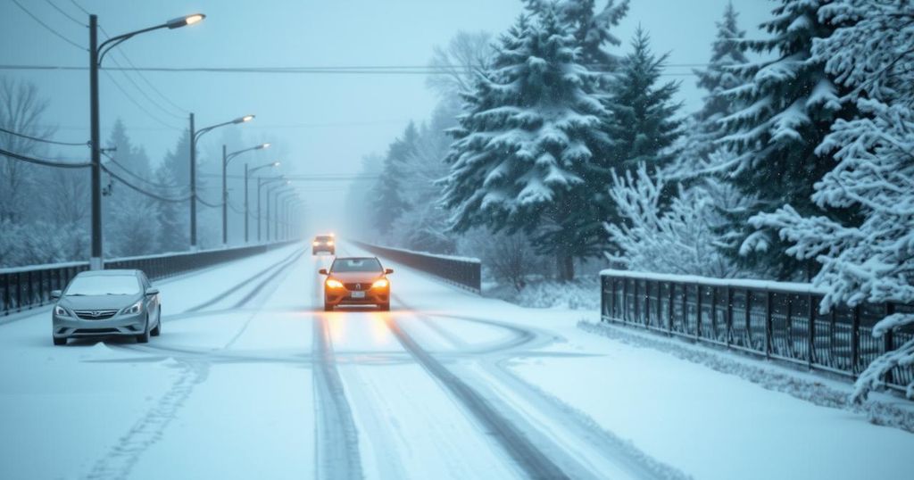
Virginia is enduring a winter storm with snow, sleet, and freezing rain predicted to last throughout today. A winter storm warning is active until Tuesday morning for much of the state. Areas north of I-64 will receive more snow, while southern Virginia may see rain. Colder temperatures are expected tonight, creating icy conditions. Sunshine is anticipated later in the week, although travel precautions remain important due to potential refreezing.
The winter storm affecting Virginia will persist today, characterized by a mix of snow, sleet, freezing rain, and rain. A winter storm warning is in effect until Tuesday morning, particularly for the northern regions, while southern Virginia remains under an advisory. As precipitation transforms into a wintry mix, colder areas can expect sleet accumulation and an icy glaze from freezing rain. By late morning and midday, areas in the metropolitan zone will likely transition to plain rain, yet regions north of I-64 will continue with a mix of wintry weather.
Come early afternoon, there may be brief periods of dry weather. Maximum temperatures are expected in the low to mid-30s. Following this, colder air will return as the storm progresses eastward, leading to renewed snowfall particularly later in the evening. Overnight snow accumulations will vary considerably, with the metro experiencing total accumulation of 1 to 3 inches, while areas further north may see an additional 2 to 4 inches, with some locations receiving up to 6 inches.
Tonight is expected to bring frigid temperatures dipping into the teens. With untreated surfaces becoming icy, caution is advised for travel during this period. From Tuesday through Friday, sunshine is anticipated, although temperatures will remain cold, hovering between the upper 20s to mid-30s during the day and dropping into single digits overnight. While direct sunlight may facilitate some melting, precautions must be taken as roadways will likely become hazardous again at night due to refreezing conditions. Additionally, forecasts suggest the possibility of another storm between Friday and Saturday.
This article discusses a winter storm currently impacting Virginia, including various types of precipitation such as snow, sleet, and freezing rain. The storm has prompted a winter storm warning for much of the state, particularly affecting areas north of I-64. The article provides insights into expected weather patterns, potential travel hazards, and temperature forecasts following the storm’s passage. It aims to inform residents of necessary precautions and prepare them for changing weather conditions over the coming days.
In summary, Virginia is experiencing a significant winter storm with a variety of wintry weather conditions occurring today. While some areas will transition to rain, others will see ongoing snowfall and freezing rain, creating hazardous conditions. The region is expected to experience a return to much colder temperatures this evening. Residents are advised to remain vigilant for possible travel hazards and stay updated on additional weather forecasts as another potential storm may be on the horizon later this week.
Original Source: www.wtvr.com


Post Comment