Hawaii Island under First Alert Weather Day Amid Storm Disturbance
Hawaii Island is under a First Alert Weather Day due to an upper-level low bringing severe thunderstorms, heavy rainfall, and potential snowfall in higher elevations. While conditions will gradually improve over the weekend, lingering showers are expected, especially in eastern areas. Residents are urged to stay informed using weather tracking applications.
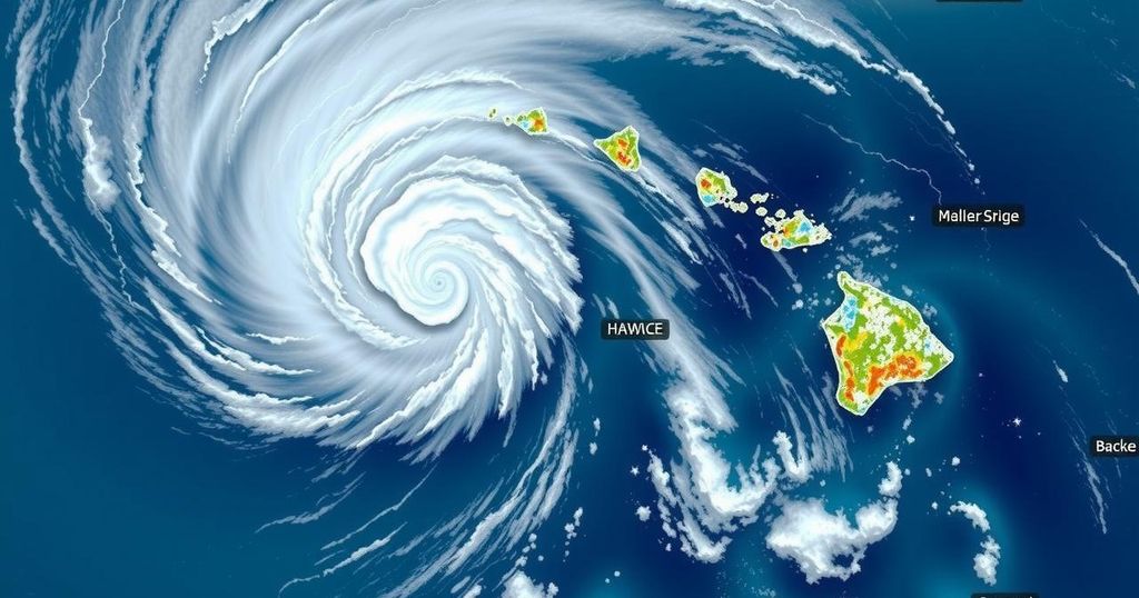
On Friday, the HNN First Alert Weather Team designated it as a First Alert Weather Day for Hawaii Island and the eastern coastal waters extending from Maui County to Hawaii Island. The weather advisory concerns a significant upper-level low isolated from the jet stream. The morning commenced with numerous thunderstorms affecting both Maui and Hawaii Island, including severe storms characterized by hail and powerful straight-line winds exceeding 50 mph. As the system lingers near Hawaii Island, meteorologists continue to observe the instability, which is expected to persist into Saturday.
As the day progresses, the trend in heavy rainfall over Oahu and parts of Maui County is anticipated to decrease, leading to a generally expected return of fair weather across most islands throughout the weekend. However, light windward trade showers may persist around Hawaii Island and eastern Maui, especially during nighttime and early morning hours, with a possibility of isolated thunderstorms developing across eastern coastal waters and mauka neighborhoods of Hawaii Island.
The afternoon could witness additional instability and convection, particularly affecting the Kona slopes, where heavier showers may arise due to developing seabreezes. In addition, the upper-level low’s trough axis is predicted to elongate and alter its position to a southwest-northeast alignment over or just east of the Big Island, maintaining enhanced trade wind showers in the forecast, particularly upstream of these regions. While fair weather is expected predominantly over Kauai and Oahu, a rare phenomenon occurred at Haleakala, where passing showers and thunderstorms led to a dusting of snow accompanied by strong winds, creating low visibility and icy road conditions to elevations of 6000 feet.
The unique weather dynamics may also bring snow and gusty winds to the summits of Hawaii Island as colder air aloft clashes with instability associated with the upper-level low. For those tracking this rapidly changing weather, the First Alert weather APP, along with the interactive radar, serves as an invaluable resource for monitoring the formation of precipitation cells in real time.
The article discusses the significant weather alert for Hawaii Island triggered by the emergence of an upper-level low system, which separates from the jet stream. This weather event is marked by thunderstorms, heavy rains, and potential snowfall in higher elevations. The First Alert Weather Day serves to inform the public about the instability and unpredictability of current weather patterns affecting various regions in Hawaii, particularly Maui and the Big Island. The article also highlights the resources available to monitor these changes effectively, emphasizing a proactive approach for individuals residing in or visiting these areas.
In summary, the HNN First Alert Weather Team has flagged Friday as a First Alert Weather Day for Hawaii Island due to the influence of an upper-level low, leading to severe thunderstorms and potential for further instability. Though conditions are expected to improve over the weekend, some lingering light showers may persist, particularly around windward areas. Residents and visitors are encouraged to utilize weather monitoring tools to stay updated on the evolving weather patterns throughout the islands.
Original Source: www.hawaiinewsnow.com


Post Comment