Hurricane Kristy Tracker: Category 5 Storm Strengthens, Poses Rip Current Threat to Baja Coast
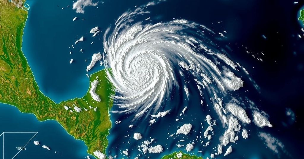
Hurricane Kristy has intensified into a Category 5 storm, currently situated off the southwestern coast of Baja California, Mexico. The storm features winds of 160 mph and is expected to generate hazardous surf conditions and dangerous rip currents by the weekend, despite not posing an immediate threat to land. As it progresses, Kristy is anticipated to weaken due to changing atmospheric conditions.
Hurricane Kristy has escalated to a formidable Category 5 storm in the Pacific Ocean, exhibiting sustained winds of up to 160 mph, as reported by the National Hurricane Center (NHC). Positioned approximately 650 miles southwest of the Baja California peninsula in Mexico, Kristy is currently traveling westward at a rate of 16 mph. While the storm’s trajectory is forecasted to keep it offshore, significant swells are anticipated to impact the Baja coast, creating perilous surf and rip current conditions by the upcoming weekend. The rapid intensification of Hurricane Kristy occurred shortly after its formation near the southern Pacific coast of Mexico, with the storm quickly evolving from a tropical storm to a Category 5 status. The NHC indicates that Kristy will maintain its westward course for the following 24 hours before gradually shifting towards a northwest trajectory. Although the current atmospheric conditions appear propitious for sustaining the storm’s strength, it is expected that cooler sea surface temperatures and wind shear will contribute to a gradual weakening of Kristy over the ensuing days, possibly downgrading it to a post-tropical cyclone within 96 hours. At present, no coastal warnings or watches are in effect; however, the NHC has issued alerts regarding hazardous conditions for beachgoers and surfers frequenting the Baja California coast. The substantial swells resulting from Hurricane Kristy are likely to generate dangerous rip currents that may pose serious risks to individuals in proximity to the water. The NHC strongly recommends exercising extreme caution in the designated areas through the weekend. Hurricane Kristy marks the 11th named storm of the eastern Pacific hurricane season, which spans from May 15 to November 30. Historically, this season averages approximately 15 named storms and eight hurricanes, making Kristy’s emergence a notable occurrence in the peak of storm activities within the region.
The Pacific hurricane season stretches from mid-May to late November, during which numerous tropical storms and hurricanes may develop, influenced by the unique climatic conditions prevalent in the region. The National Hurricane Center monitors these storms, providing critical updates and forecasts that guide both public safety and response efforts. The formation and intensification of storms such as Hurricane Kristy highlight the dynamism of oceanic weather patterns and the importance of preparedness in coastal areas prone to such natural events.
In summary, Hurricane Kristy has developed into a powerful Category 5 storm, posing significant threats to maritime safety in the form of hazardous surf and rip current conditions along the Baja California coastline. Although the storm’s projected path indicates a movement away from land, beach safety remains paramount as ocean swells may become dangerous. The cooling waters and various atmospheric factors are expected to diminish Kristy’s strength in the near future. As part of the ongoing Pacific hurricane season, Kristy’s rapid intensification emphasizes the necessity for vigilance among residents and visitors in affected regions.
Original Source: www.speaksly.net


Post Comment