Understanding Potential Tropical Cyclone #19 and Its Impacts on Central America
Potential Tropical Cyclone #19 is likely to develop into a tropical storm, posing significant rainfall and flooding threats to Central America, particularly Honduras. Wind conditions may become severe by Friday, while the system’s potential impact on the Gulf remains uncertain. Authorities have issued watches to prepare for hazardous conditions.
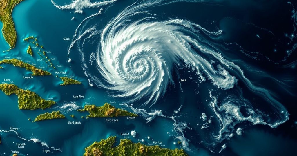
As the week progresses, observers are closely monitoring Potential Tropical Cyclone 19 as it sluggishly traverses the Caribbean. The system is anticipated to strengthen into a tropical depression or tropical storm, potentially named Sara, by Thursday afternoon. Forecasts predict maximum sustained winds at approximately 30 mph, with conceivable increases in strength as it approaches Central America, potentially leading to hazardous flooding conditions in the region. Although uncertainty remains regarding its trajectory and potential impact on the Gulf of Mexico, the interaction of this system with a frontal system and trough of low pressure next week will significantly influence its path. Presently, it is prudent to remain vigilant, yet there is no immediate cause for alarm regarding its potential effects on the state of Florida’s southwest region. The impending system poses a significant rainfall threat to Central America, with forecasts indicating accumulations ranging from 10 to 20 inches, particularly in northern Honduras, where local totals could reach up to 30 inches. This excessive rainfall is likely to cause severe flash flooding and mudslides, predominantly in areas adjacent to the Sierra La Esperanza. Further impacts are anticipated across parts of Honduras, Belize, El Salvador, eastern Guatemala, and western Nicaragua, where substantial rainfall amounts may also give rise to flash flooding. In addition to rainfall, the system could generate harsh wind conditions with hurricane-force winds anticipated as early as Friday in designated watch areas. Tropical storm conditions may commence late Thursday along associated regions. Furthermore, regions along the northern coast of Honduras might encounter storm surges elevating water levels by 1 to 3 feet above normal, coupled with damaging waves.
The formation of Potential Tropical Cyclone #19 represents a significant meteorological event, occurring as the Atlantic hurricane season progresses. Meteorologists are tasked with predicting the system’s development and potential impact on coastal regions, particularly Central America, where severe weather conditions are likely. Understanding the factors influencing tropical cyclones, including wind patterns and atmospheric pressure changes, is essential for accurate forecasting and timely alerts to affected populations.
In summary, Potential Tropical Cyclone #19 is being closely monitored as it is expected to strengthen and could become a tropical storm by Thursday. While Central America faces an imminent risk of heavy rainfall and flash flooding, uncertainty remains concerning its path towards the Gulf of Mexico. Vigilance is recommended for those in the potential impact zones, but immediate concerns are not yet warranted. Authorities in Honduras and Nicaragua have issued appropriate warnings to ensure public safety.
Original Source: www.fox4now.com


Post Comment